Lotto
PROJECT
LOTTO
PROJECT
Project overview
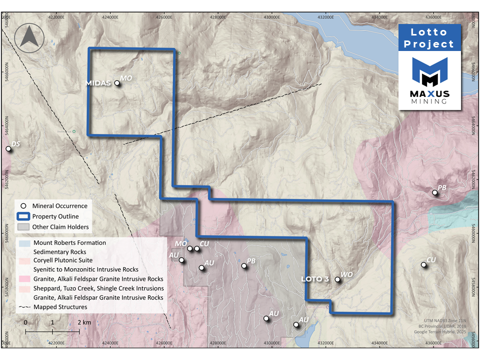
The 3,054-hectare Lotto Tungsten Project is in the Trail Creek Mining Division of BC, a prolific mineral district known for its resource potential and well-developed infrastructure.
-
The 3,054 hectare Lotto Project contains the Lotto 3 showing which consists of scheelite (tungsten mineral) mineralization within a 9-meter-wide quartz vein.
-
Disseminated scheelite occurs in quartz veins just northwest of the main showing and in several places west of the highway.
-
A selected grab sample taken in 1980 from a quartz vein with scheelite assayed 10.97% Wo3 (Assessment Report 8187).1
Source 1: MILFILE No: 082FSW228 – Loto 3, 1980 Grab Sample – Link
Tungsten and Critical Mineral Potential
Across 14km of Favourable Stratigraphy
-
High-grade Tungsten mineralization
Historical samples containing visible scheelite mineralization at the Loto 3 showing returned assays up to 10.97% WO3.1,2
-
Polymetallic Potential
Historical geochemical soil sampling identified anomalous zones of Mo, Cu, Ag, Zn, and W in the Midas showing area, associated with key structural controls.3
-
Prime Jurisdiction & Location
Lotto is road accessible, strategically located along the Crowsnest highway in the Trail Creek Mining District less than 20 kilometres away from Castlegar, BC.
-
2025 Prospecting Program
The Company recently completed a ground-truth sampling program across historical showings – assays pending.
previous work
-
In 2006, Astral Mining Corporation conducted a helicopter-borne geophysical (electromagnetic survey on the area as part of the JJ property).
-
The electromagnetic survey showed the area is underlain by Paleozoic argillaceous quartzites and argillites which may be part of the Lower Jurassic Rossland Group.
-
These metamorphosed sediments have been intruded by the Middle to late Jurassic Nelson Intrusions, comprised mainly of granite and granodiorite, and then later by Middle Eocene Coryell Intrusion syenite and associated dykes.