HURLEY
PROJECT
HURLEY
PROJECT
Project overview
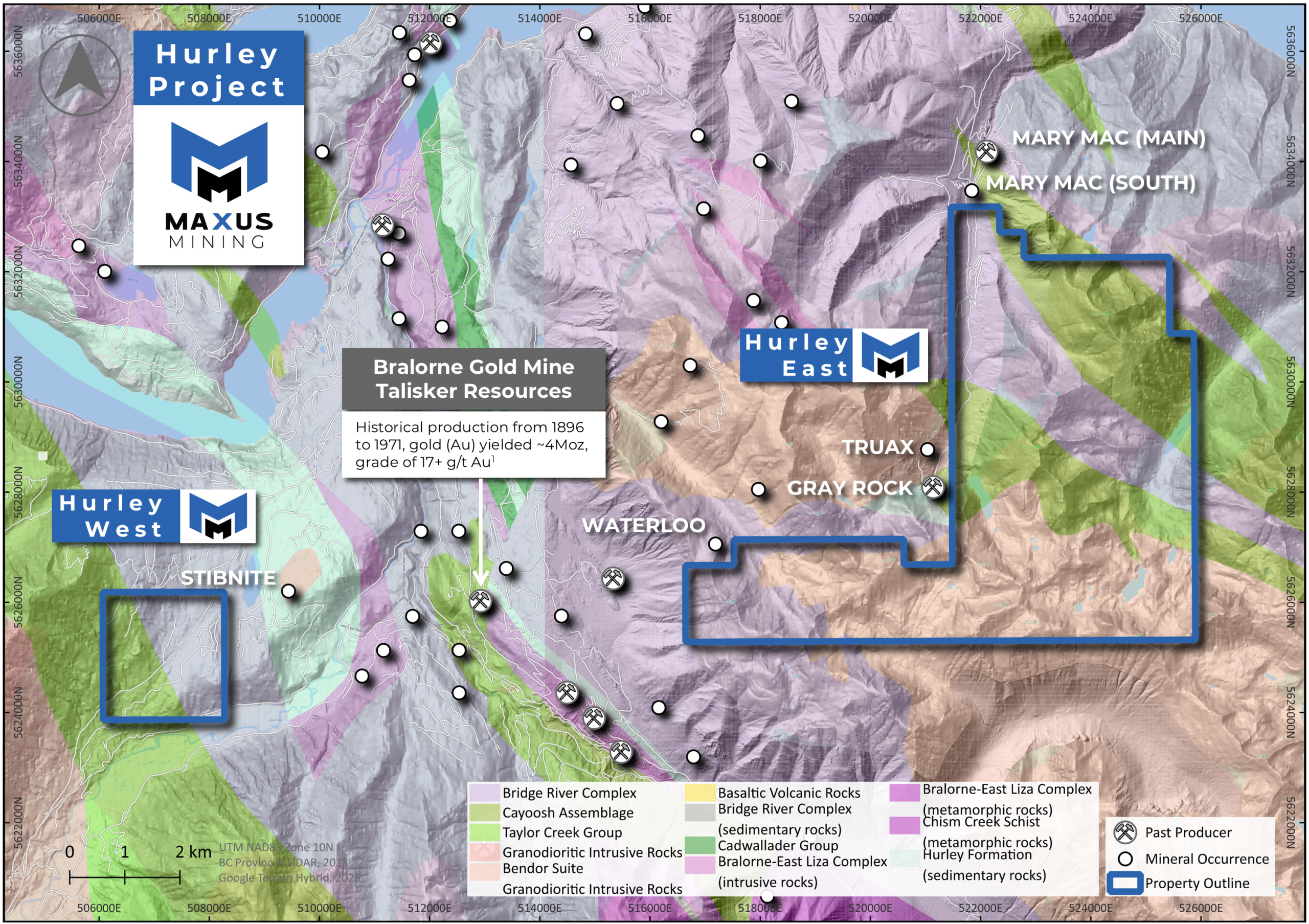
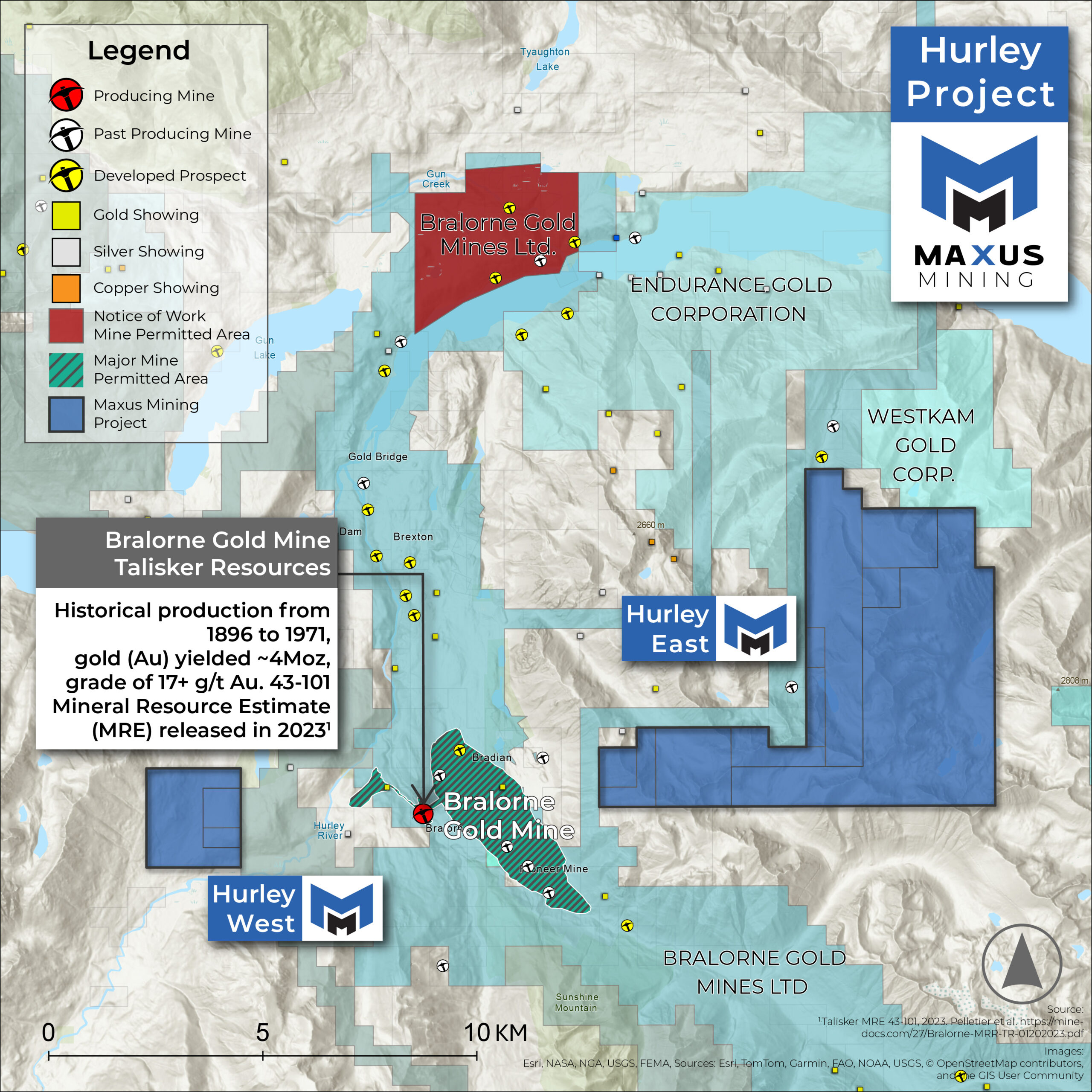
The Hurley Antimony Project, spanning ~4,432 hectares, is located 7 kilometers south-east of the village of Gold Bridge, and 10 kilometers east of the historic Bralorne-Pioneer Gold Mining Camp which has produced over 4 million ounces of gold.
-
The adjacent Reliance Gold Project reported intervals that include 19.2% Sb and 2.16 g/t Au over 0.5m encountered during 2024 drilling campaign.
-
A total of 199 gold assay composites were re-calculated to include antimony results from the 108 DDH, 84 RC, and 24 road cut channels completed by the Company which has resulted in a composite average sampled length of 10.1 meters and weighted average grade of 4.55 gpt, 0.20% antimony, and 4.97 gpt AuEQ.
Source 1: Olympus West, EK, Tom, Chris, Tam, Tim – 24-Oct-1995, Keith J. Mountjoy – MINFILE 0.82KSW175 – Link
previous work
-
In 2006, Astral Mining Corporation conducted a helicopter-borne geophysical (electromagnetic survey on the area as part of the JJ property).
-
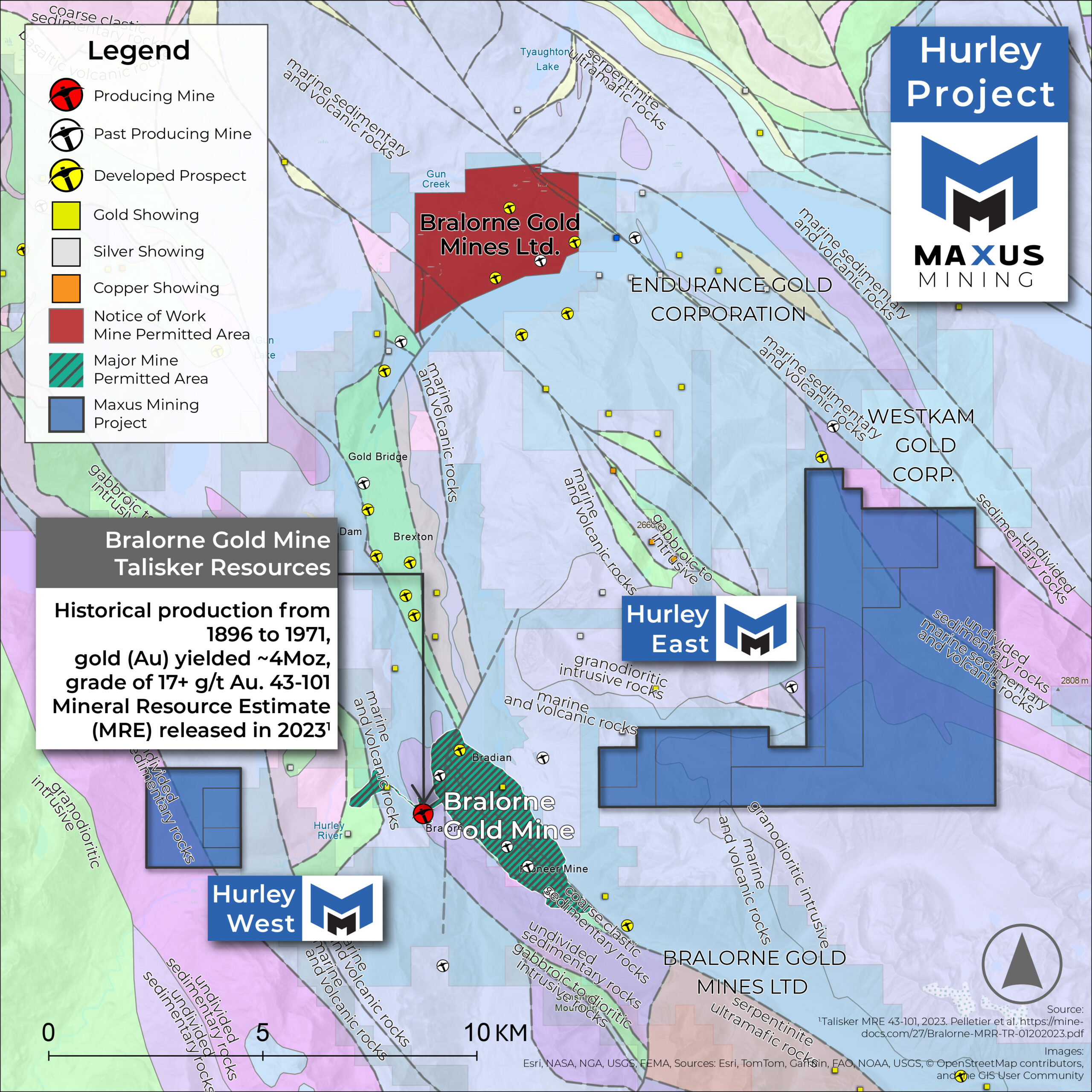
The electromagnetic survey showed the area is underlain by Paleozoic argillaceous quartzites and argillites which may be part of the Lower Jurassic Rossland Group.
-
These metamorphosed sediments have been intruded by the Middle to late Jurassic Nelson Intrusions, comprised mainly of granite and granodiorite, and then later by Middle Eocene Coryell Intrusion syenite and associated dykes.
CRITICAL MINERAL &
GOLD POTENTIAL
4,432 Hectares of Prospective Terrane in the historic Bralorne Gold Mining Camp.
The historic Bralorne-Pioneer Gold Mining Camp in BC has produced over 4 million ounces of gold.1
Hurley lies immediately south of the Mary Mac Main Zone – a gold-antimony past producer – four tonnes of stibnite/day with grades of 20% Sb over 2.1 meters and reserves of 13.6 to 18.1 thousand tonnes.2
Favorable host rocks: Prospects on Hurley closely resemble the geological setting of neighbouring discoveries and mines.
- High-grade Antimony Showings: Stibnite mineralization present in veins on the western claims of Hurley – Decimeter-scale veins in 60-meter-long shears with average grade of 8.9 % Sb.3
- 2025 Prospecting Program: The Company recently completed a ground-truth sampling program across historical showings – assays included 11.60 g/t Au in outcrop, 9.33% Sb in talus, 0.18% Sb in outcrop.4